
Filter by
SubjectRequired
LanguageRequired
The language used throughout the course, in both instruction and assessments.
Learning ProductRequired
LevelRequired
DurationRequired
SkillsRequired
SubtitlesRequired
EducatorRequired
Results for "geospatial mapping"
 Status: Free Trial
L&T EduTech
Skills you'll gain: Construction Engineering, Geospatial Mapping, Geospatial Information and Technology, Geographic Information Systems, Spatial Data Analysis, Construction, Construction Management, Visualization (Computer Graphics), Spatial Analysis, Global Positioning Systems, GIS Software, As-Built Drawings, Survey Creation, AutoCAD Civil 3D, 3D Modeling, Data Import/Export
 Status: NewStatus: Free Trial
Skillshare
Skills you'll gain: Photography, Photo Editing, Storytelling, Image Quality, Geospatial Mapping, Design Elements And Principles, Geospatial Information and Technology, Geographic Information Systems, Photo/Video Production and Technology, Spatial Data Analysis, Global Positioning Systems, Adobe Creative Cloud, Creative Thinking, Planning, Timelines, Aesthetics
 Status: Free Trial
University of California, Davis
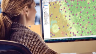
Skills you'll gain: ArcGIS, Data Storytelling, Spatial Data Analysis, Data Presentation, Geographic Information Systems, Spatial Analysis, Geospatial Mapping, Heat Maps, Data Visualization Software, Network Analysis, Data Manipulation
 Status: Free Trial
University of Toronto
Skills you'll gain: ArcGIS, Spatial Data Analysis, Geographic Information Systems, Spatial Analysis, Geospatial Mapping, Data Mapping, Global Positioning Systems, Data Capture
 Status: NewStatus: Free Trial
Coursera Instructor Network
Skills you'll gain: Power Electronics, Thermal Management, Electrical Safety, Electrical Power, Electric Power Systems, Electronic Systems, Electrical Equipment, Electrical Systems, Embedded Software, Electronic Components, Energy and Utilities, HVAC, Basic Electrical Systems, Sustainable Technologies, Automation, Environmental Issue, Environment and Resource Management, Environmental Regulations, Environmental Engineering and Restoration, Geospatial Information and Technology
 Status: Free Trial
L&T EduTech
Skills you'll gain: Geospatial Information and Technology, Spatial Analysis, Geographic Information Systems, GIS Software, Database Management, ArcGIS, Global Positioning Systems, Decision Support Systems, Data Modeling, Open Source Technology, Web Applications, Mobile Development
 Status: NewStatus: Free Trial
University of Pittsburgh
Skills you'll gain: Data Storytelling, Interactive Data Visualization, Data Presentation, Plot (Graphics), Data Visualization Software, Data Visualization, Tableau Software, Spatial Analysis, Visualization (Computer Graphics), Statistical Visualization, Network Model, Dashboard, Matplotlib, Infographics, Heat Maps, Seaborn, Geospatial Information and Technology, Time Series Analysis and Forecasting, Network Analysis, Geospatial Mapping
 Status: Free Trial
Coursera Instructor Network
Skills you'll gain: Generative AI, Customer Insights, AI Personalization, Customer Analysis, ChatGPT, Customer experience strategy (CX), Real Time Data, Persona Development, Design Thinking, Predictive Analytics, Artificial Intelligence, Analysis, Design
 Status: Free Trial
University of Michigan
Skills you'll gain: Sustainable Development, Geographic Information Systems, Geospatial Mapping, Sustainability Reporting, Spatial Data Analysis, Sustainable Business, Spatial Analysis, Data Storytelling, Environmental Monitoring, Data Visualization, Stakeholder Engagement, Trend Analysis, Decision Making
 Status: Preview
UNSW Sydney (The University of New South Wales)
Skills you'll gain: Image Analysis, Unsupervised Learning, Geospatial Information and Technology, Computer Vision, Spatial Analysis, Machine Learning, Dimensionality Reduction, Linear Algebra, Deep Learning, Data Validation, Supervised Learning, Probability & Statistics, Artificial Neural Networks
 Status: Preview
Coursera Instructor Network
Skills you'll gain: Geographic Information Systems, Geospatial Information and Technology, Geospatial Mapping, Spatial Data Analysis, Spatial Analysis, Global Positioning Systems, Data Analysis
 Status: NewStatus: Free Trial
Skills you'll gain: Hibernate (Java), Object-Relational Mapping, CI/CD, Spring Boot, Restful API, Java Programming, Integration Testing, Continuous Integration, Database Development, Application Security, Java, Containerization, SQL, Databases, Application Frameworks, NoSQL, Docker (Software), Kubernetes, Test Driven Development (TDD), Object Oriented Design
In summary, here are 10 of our most popular geospatial mapping courses
- Geospatial Technology for Construction : L&T EduTech
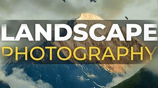
- Landscape Photography: Skillshare
- Geospatial Analysis with ArcGIS : University of California, Davis
- Introduction to GIS Mapping: University of Toronto
- Electric Vehicle Systems and Technologies: Coursera Instructor Network
- Geospatial Information Technology Essentials: L&T EduTech
- Data Visualization: Fundamentals to Interactive Storytelling: University of Pittsburgh
- GenAI for Customer Journey Mapping: Coursera Instructor Network
- GIS: Geographic Information Systems for Sustainability: University of Michigan
- Remote Sensing Image Acquisition, Analysis and Applications: UNSW Sydney (The University of New South Wales)


